
Property Development in Rooiels
Development of property today is very different to the way things happened in the past. Gone are the good old days, when a handshake with a neighbour resolved a property boundary dispute or the siting of a new building on a property. In fact, the one thing that seems to be missing from property development, particularly in a small village like Rooiels, is the concept of being a good neighbour at all.
Today, much is made of the rules and regulations that govern what a person can or cannot do on a property. Disputes are more likely to be settled in a court of law rather than over a beer or glass of whiskey, and more often than not, for no good reason at all, often being based on an incorrect interpretation or misunderstanding of the applicable legislation.
But the law is the law and even if you are lucky enough to have an understanding neighbour, you still need to comply with the law. You can guarantee that someone will be watching!
So how does the law work in property development? There are basically four areas of overlapping legislation that control typical property development as one would experience in a village like Rooiels. These are each discussed briefly below.
Title Deed Restrictions
Prior to the introduction of more recent legislation, development of new subdivided plots was controlled by means of title deed
restrictions which were often also imposed by the Administrator of the Province as “township conditions”.
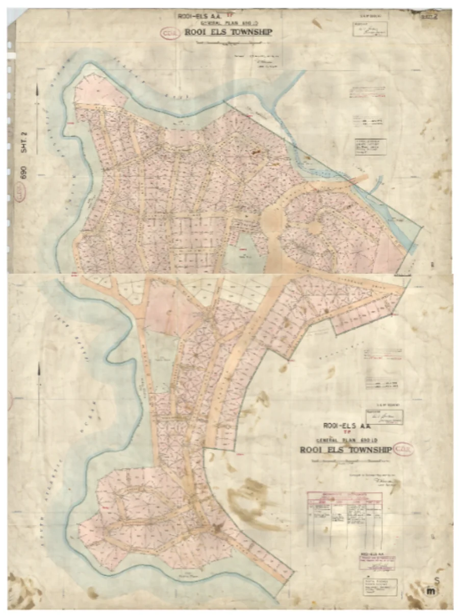
The Rooiels Township was approved in 1948 in terms of the Township Ordinance 33 of 1934, prior to the introduction of modern zoning schemes. Conditions of development were entrenched in the Title Deeds and all title deeds of residential properties in Rooiels have similar conditions. Some of these conditions are in favour “of the registered owner of any Erf in the township” whilst others are in favour of the Administrator (now the Local Authority).
Typically, these Title Deed conditions limit the use (residential purposes), further subdivision, type of building (no wood or iron buildings) and provide for building lines on street, lateral and rear building lines.
Where a proposed development of an erf is in conflict with a title condition, and depending on what the conflict is and what condition is affected, the necessary land use application for either the removal of the Title condition or its relaxation is required to be made and approved before development can occur.
The National Environmental Management Act (NEMA)
This national act is managed at provincial level by the Department of Environment and Development Planning (DEA&DP – colloquially known as “Dead P”).
Depending on the nature of the proposed development, its location and the receiving environment, the provisions of the act may apply. If the proposal triggers any of the provisions of the act as set out in the regulations or listing notices, then the development can only proceed once authorisation has been given by DEA&DP following either a Basic Environmental Assessment (BAR) or a full and detailed Environmental Impact Assessment (EIA).
Environmental applications are normally accompanied by specialist studies required as a consequence of the nature of the development. These studies include, for example, wetland, freshwater, botanical, faunal, visual etc. Identified interested and affected parties have the opportunity to comment on the assessment prior to the record of decision being issued by DEA&DP which may or may not include conditions of approval.
The National Heritage resources Act (NHRA)
As with NEMA, this national act is managed at provincial level by Heritage Western Cape (HWC). Part 2 of the NHRA provides for general protections of:
- Buildings older than 60 years.
- Archaeology, palaeontology and meteorites.
- Graves.
- A range of activities which require:
-
- A Notice of Intent to develop.
- A full Heritage Impact Assessment if required by HWC.
If required by the NHRA, development of the property may not proceed without a positive Record of Decision which may or may not include conditions of approval.
Land Use Planning
In terms of the Constitution, the management of property development is a local authority function. However, to complicate things, this function is part of a broader legislative framework.
- At national level, the National Spatial Planning and Land Use Management Act (SPLUMA) requires each province to generate its own provincial planning legislation (in the Western Cape, the Land Use Planning Act (LUPA)).
- In turn, local authorities are required to promulgate their own planning by-law under the provincial legislation. This by-law allows for local zoning schemes and associated overlay zones to be enacted and applied.
And if this is not complicated enough, running in parallel to the land use legislation are the National Building Regulations which dictate (once you have all the other approvals) how a building can be built. In light of the above, it’s a miracle that anything happens at all let alone properly.
Read more about building and renovating in Rooiels.
Overstrand Zoning Scheme
Simply put, every piece of land is required to be zoned in accordance with the applicable local zoning scheme and this zone is recorded on a plan. In the case of Rooiels, this is the Overstrand Zoning Scheme which was promulgated in 2020.
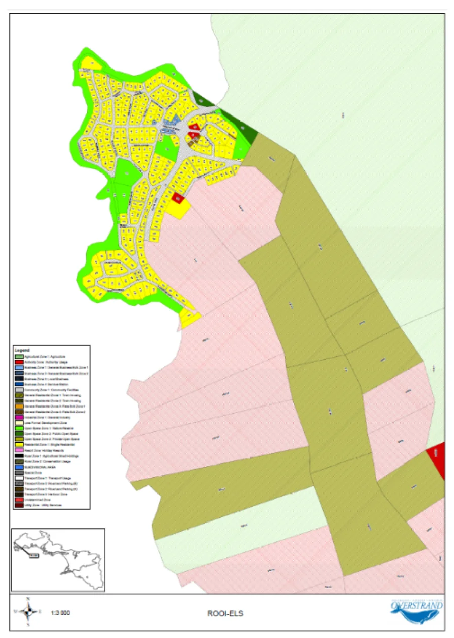
Within the village the majority of the properties are zoned “Residential Zone 1 – Single Residential”. The zoning scheme then dictates what the property can be used for (primary uses and uses permitted with consent of council) and the form of the development permitted on the property concerned.
Development parameters include 50% coverage for plots bigger than 400m², a 4 metre setback from street boundary, 2 metre setbacks from common boundaries and a height restriction of 8 metres from base level.
Overlay Zones
In addition to the zone, properties may also be subject to the provisions of one or other overlay zone. Overlay zones provide additional development controls in specific areas for specific reasons. In Rooiels these are the Environmental Management Overlay Zone (EMOZ) and the Heritage Protection Overlay Zone (HPOZ).
The EMOZ provides regulations to manage the coastal, mountain catchment, buffer, riverine and urban conservation areas.
The HPOZ deals specifically with the scenic corridor (Clarence Drive), the coastal strip, a range of site-specific areas outside of Rooiels and the Rooiels-specific HPOZ.
Normally, the greatest restriction applies to the development. So where a title deed building line is greater than a zoning building line, the title deed requirement supersedes that of the zoning scheme. The same applies to the provisions of the applicable overlay zone, except for the HPOZ, which for some bizarre reason, only applies to developments seeking additional rights.
Redevelopment and new developments in Rooiels are now driven by high value attached to property in the area. New buildings are associated with this value.
There have been many instances in the more recent past where recognition (through good urban design and architecture) of the special Rooiels context and sensitivity to neighbours and streets, has been lost. Largely, this is because it is easier to simply comply with the legislation, rather than asking for permission (through a land use application) to allow for something better.
Both the by-law and the zoning scheme (including the overlay zones) are about to undergo a formal review and we must take care to use this opportunity to improve the applicable legislation and ensure that Rooiels is better protected and managed going forward.